Manned Airborne Real-time Surveillance & Observation
One of the ‘hot spots’ in Frankfurt is called MARSO, an abbreviation for Manned Airborne Real-time Surveillance & Observation. A development by M4Com System GmbH, Peiport Industries Ltd., Trixy Aviation, and RST Radar Systemtechnik GmbH, it is described as a versatile surveillance system for missions ranging from large area ship detection via side-looking radar to vehicle tracking. The latter is undertaken via optical and IR video streams.
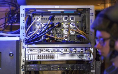
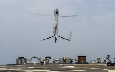
Trixy Aviation, a research and development company in Austria and in Slovenia, supplied its gyrocopter, which the company describes as a “very light” airborne platform that can be operated “up to 200km” from a mobile ground control station (GCS). The latter ideally is M4Com’s ground segment, enabling modular, multi-sensor and multi-inteligence surveillance and exploitation with next-generation data storage and retrieval capabilities. Data sharing is facilitated by the same firm’s COFDM datalink system.
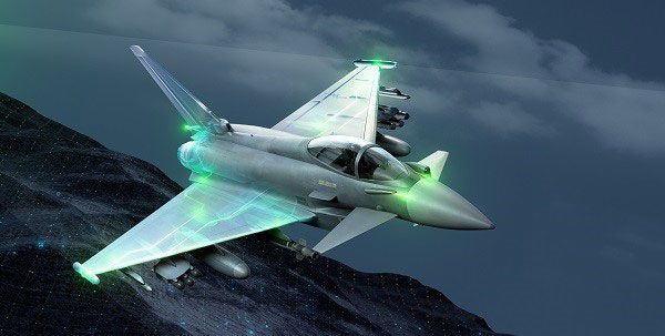
MARSO is designed as a system that can be easily integrated into existing surveillance architectures. For various missions, a number of payloads can be carried by the four-axis, gyro-stabilised SkyEye 2X-3 gimbal, a development by Peiport Industries. This architecture includes an HD daylight camera (Sony), an uncooled thermal camera (FLIR Systems), and a laser rangefinder, with the latter offering a detection range of 4.5 kilometres.
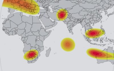
The air vehicle’s radar payload is RST’s WSMS-S side-looking imaging radar. It is designed for fast coverage of huge areas most typical of the maritime security environment. “The radar’s swath width is quoted at approximately 40km (switchable left or right), depending on the resolution,” Uwe Karl, RST’s Head of Sales and Marketing, told MONS. An area measuring up to 4,000sqkm can be monitored within an hours, according to RST, a German company specialising in space-borne, airborne, and ground-based radars.
The story does not end here. The gyrocopter can also deploy small unmanned aircraft for surveillance missions far away from the GCS. “Up to four drones can be carried,” Karl added. He also suggested to MONS that the gyrocopter’s very slow flying capability and the fact that it’s rotor does not produce ‘down-wash’ effects make it possible to mount the drones underneath the air vehicle. When deployed, the drones cannot be recovered in flight but the can be landed safely.
M4Com also promotes two other electronic components: the MAuS-ISR modular multi-intelligence exploitation system and LinkFinity, a full duplex IP stream and control data link system. The latter provides the capability to control the EO/IR sensor gimbal, as well as radar and other data acquisition sensors. Besides this, LinkFinity enables configurable broadband down- and uplink, the provision to send and receive video or IP streams and control data.
Maus is described as a “multi-user-capable system” based on open military and industry standards, enabling accurate access to both central and external databases, including VIDIS that is M4Com’s video exploitation and surveillance tool.
Stefan Nitschke