MONCh talks to Leonardo about their latest product launched at Farnborough Air Show
On July 17, 2018, Leonardo launched SEonSE (Smart Eyes on the SEas), a geospatial intelligence maritime security platform that has gone online. Thanks to the use of cloud computing and of advanced big data analysis models, SEonSE makes it possible to monitor in real-time what happens at sea. The announcement was made at the “Farnborough International Airshow” exhibition being held in the United Kingdom, where the solution implemented by e-GEOS (a joint venture between Telespazio 80% and ASI 20%) was presented. This platform integrates data coming from multiple sources and provides multiple services for maritime security and surveillance, monitoring of illegal traffic, environment protection as well as fight against piracy.
In an exclusive interview with Massimo Claudio Comparini, Head of Geoinformation business at Leonardo Group and CEO of e-GEOS, Marco Giulio Barone on behalf of MONCh discusses the impact of space-based sensors on geospatial intelligence platforms, with an eye on military applications and the maritime domain.
MONCh: The most known examples of geospatial intelligence applications are about mapping infrastructure, industrial activities, vehicles or material related to specific value chains. However, the military significance of gathering information this way is evident. What possible military applications do you envisage? Anything specific for the naval domain?
MCC: Well, yes, the definition of geospatial intelligence per se recalls the military significance it can have. Beyond this, the Defence&Intelligence (D&I) sector takes a 40% share of the whole intelligence-related marketplace. Hence, it is evident that as geospatial intelligence applications emerge their impact on the D&I related market will be consistent. This is true for our intelligence-specific products as well.
So far, our offer in the field is based on two main platforms.
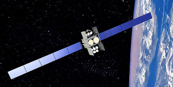
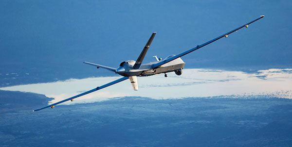
The first, Smart Eye on the SEas (SEonSE), is a maritime domain awareness platform that monitors mainly (but not only) the behaviour of ships at sea by merging data coming from various sources, including COSMO-SkyMed and Copernicus satellites, the exactEarth service providing the position of vessels, the world registry of ships, meteorological and oceanographic information. (*)
The second one is braINT, a classic platform of image intelligence for monitoring land phenomena typical for this kind of products. For instance, change detection functions are about monitoring how infrastructure changes throughout time.
In general, geospatial intelligence products are about active monitoring of what has been happening, in an attempt of detecting anomalous bias, which are behaviours different from the norm in a given time frame. Therefore, it is possible to making increasingly more reliable forecasts about what monitored actors will be doing in the future. For example, space-based radar technology allows for monitoring traffic density in uninhabited areas such as the desert – a kind of monitoring hard to perform through electro-optic observations.
As we work on unclassified data sets, our capability of merging heterogeneous sets of data and information into specific products for the military sector would represent a very important achievement, thus confirming the current trend that sees the military and civil sector increasingly cooperating on intelligence. Sometimes, the military sector can use proprietary technology which outcome is classified. For what concerns space-based information, usually it is about having higher resolution images than those available for civil purposes. Yet, some processes specifically developed for business intelligence applications – thus to achieve economic rather than military goals – are today very useful as basis for developing advanced algorithms that are of interest for the military sector.
In short, in today’s world the intelligence cycle is no longer a military-related task only; it also serves economic interests. The two sectors already have some points in common, and in the near future economic intelligence and military intelligence will intersect.
In Italy, we have extensive experience in this sense because the COSMO-Skymed satellite constellation has been thought since the beginning as a dual-use asset, thus making impossible to distinguish, at least for unclassified data, militarily-relevant from economically-relevant information. All of the actors can just use what is available tailoring it to their needs. The latest evolution in the space sector, such as small and micro satellites, further confirms this trend. More specifically, the extremely high-resolution images typical of military products will be complemented by the so called “tempo resolution”, which is the capability of observing more frequently a specific area of interest – albeit at lower resolution than big satellites. Once again, the possibility of performing a pattern-of-life analysis based on space products encompasses both business and military intelligence cycles.
MONCh: European countries are lagging behind China, the U.S. and Japan for what concerns research and investment in Artificial Intelligence (AI). For what concerns the military domain, is there interest in investing on and procuring this kind of products? Is the military aware of the potential impact AI can have on intelligence?
MCC: On this topic I can share my personal opinion. First of all, we are talking about machine learning algorithms that work on huge amounts of data and that are able to provide increasingly accurate information as they are fed by new data. In the field of intelligence such algorithms are gaining momentum. It is because of machine learning algorithms that today’s platforms are able to map actors’ behaviours in the past as well as making predictions about their future behaviour. In this sense, AI applications are of great interest for the military sector. Unfortunately, it is well known that European countries are investing much less than the US or China. However, I see that awareness on the relevance of AI has been increasing and some good signals are coming. For instance, France has established a €1.5 billion fund for AI, with Defence & Security as one of the four key sectors identified as priority (along with transportation, healthcare, and research). To me, such a plan is the clear demonstration of the growing concrete interest.
MONCh: The agreements Leonardo has signed with BlackSky and Orbital Insight show the ambition of covering the whole value chain for what concerns Earth observation services. Perhaps both companies are very promising. How did you get to mutual interest? Is this part of Leonardo’s strategic approach to the issue or, rather, those agreements have been seized as opportunities that only after have turned into something bigger?
MCC: These two agreements are very good for demonstrating the way we intend to cover the whole value chain. Join ventures established throughout the years go from end-toend mission design and satellite manufacturing capabilities (Thales Alenia Space) to ground infrastructure and ground stations (Telespazio) and to services (e-GEOS).
BlackSky is a constellation that will include 60 satellites to be launched in three phases of 20 satellites each. The constellation will feature electro-optic sensors that will allow for 1m resolution. BlackSky will substantiate the concept of “tempo resolution” we have been talking about. Once completed, the constellation will allow for a revisit time as short as one hour over the most relevant latitudes worldwide – which is a much more frequent revisit time than today.
Naturally, Telespazio will greatly benefit of such an incoming flow of information for feeding its service platforms, including D&I ones, and to merge optic observations and radar monitoring. In fact, in compliance with the agreement with ASI (Agenzia Spaziale Italiana, Italian Space Agency), e-GEOS can distribute worldwide data from the COSMO-Skymed constellation.
Orbital Insight is on the opposite side of the value chain. The company was born two years ago, and it is very promising in the field of data analytics. As it was born mainly through private financing, its original area of interest is business intelligence. The agreement we had with Orbital Insight is the confirmation that the strategic planning effort we have made two years ago on information extraction and processing has been going in the right direction. Leveraging on the technological capacity COSMO-Skymed can deliver on, thorough discussions have been possible between us and Orbital Insight. At the end, complementarities emerged, and the final deal is mutually satisfactory. Thanks to them, we can now provide for instance emergency services to the US institutional market – an achievement I deem a proof of Italian competitiveness in the field. Furthermore, the fact that we can import US technology to Europe means getting technologies we do not have, thus contributing to close the gap in fields that are already developed in the US. Therefore, in Europe, we expect to play as protagonists.
MONCh: Meanwhile, in Europe, the debate on the so called “strategic autonomy” is progressing. Can this have a negative impact on US technology import to Europe? How does it work for your segment?
MCC: This part concerns the manufacturing side of our offer, which follows the ITAR (International Traffic in Arms Regulation) related dynamics, with its good and bad aspects. Traditionally, some countries – like France – have always sought the possibility of having ITAR-free components. Putting aside considerations about the economic convenience of implementing a totally ITAR-free production, I can tell through my previous experience at Thales Alenia Space that we complied with ITAR and in the kind of markets we move in we never had problems.
For what concerns services, COSMO-Skymed has been developed with more than 80% Italian technology; this is the demonstration that when technology is available, advanced and cutting edge, it spreads without any concern. What I am trying to say is that the problem of ITAR is a broader issue that goes beyond the single domain, and which principles should be revised. For instance, in the years ahead, China will launch plenty of satellites for Earth observation. Even if they might include some outdated technology, the lack of state of the art technologies has not prevented the country before from obtaining consistent number of assets that it will use for generating data.
MONCh: We know how standard military procurement works, from operational requirements to delivery. As we are talking about new technologies and services, what is the pathway from development to deployment? What kind of offer could be wrapped up for a naval force or a coast guard?
MCC: This domain is an ever-evolving one, so we are building our offer as needs and requirements come. Should one of our platforms be of interest for a military institution, it would need to be certified like any other piece of hardware, according to the same procedures. As the sector evolves, I hope such possibility will come soon. For now, our platforms are tailored for commercial interest only, but it is not a big issue working on a certified version for military purposes.
MONCh: Predictive analytics based on algorithms that turn observations into data may have a point of weakness: should the observed subject know it is monitored, it could change its behaviour to deceive tracking. Is this a challenge for geospatial intelligence applications? What mitigation measures can be put in place for coping with it?
MCC: The answer is twofold.
First, as we observe from space, dissimulating or hiding something is much more difficult. The capacity of tracking via radar hundreds of miles and then to refine the initial observation with very high-resolution images focused on specific objects reduces dramatically the edge for who might want to trick the system.
Second, fusion of heterogeneous data works like a continuous cross-checking process. For instance, I might turn off the AIS and become a non-cooperative ship in an attempt to avoid those algorithms deputed to process AIS related data. As the algorithm is not fed, forecast on the potential route will become increasingly less reliant and the ship might become invisible. However, if the algorithm is fed also with space images, density of phone and/or radio communication, and so forth, all information available combine and eventually replace each other. This makes it extremely complicated to become invisible to a geospatial intelligence application, especially those ones integrating satellite data as well.
SEonSE works exactly this way. Starting with radar observation from space we have complemented it with EO capacities, and subsequently with further layers of other data, such as AIS positioning and/or, simply, weather conditions in the area of interest. Hence, advanced algorithms allow for both prescriptive and predictive analysis. Before, most of geospatial intelligence solutions could monitor one domain only; today, we are able to monitor multiple domains at the same time. For instance, the status of sea and wind can provide useful elements to predict the maximum speed a vessel can have or indicating which are the most convenient routes for it. In terms of maritime security, this means being able to outline an area of interest to launch a search & rescue operation or to plan an interception. In perspective, even sub-surface data can be integrated. The more layers we are able to add, the more sophisticated the algorithm will be and, consequently, the more difficult it will become to deceive it.
MONCh: The quantity and quality of information based on Earth observation might represent a high-value target for hackers. How are sensitive data and deliverables kept safe from cyber-attacks? What kind of measures can be taken?
In substance, there is no difference between these and other data sets in the approach to protect them. Naturally, we pay much attention to cyber-security and we make sure to have the most robust and resilient protection systems. Nevertheless, in this specific sector we have growing challenges due to the fact that information will have to be disseminated to customers. On the one hand, sensitive or classified data are protected by barriers that make difficult to have access to them. On the other, we cannot deliver on geoinformation services without using cloud technology, regardless of the sector the customer belongs to – be it agriculture, industry, or security. Hence, we need to find a balance between resilience to cyber-attacks and the possibility of delivering our services globally. For this reason, cybersecurity is an aspect we take into consideration since the beginning, when we establish the architecture of our solutions.
(*) At Farnborough, e-GEOS and exactEarth have signed a dedicated partnership agreement. According to Leonardo figures, 7 million AIS signals are sent every day by about 165,000 vessels which are managed by exactEarth, the worldwide leader in Satellite AIS data services for global tracking of commercial ships.